
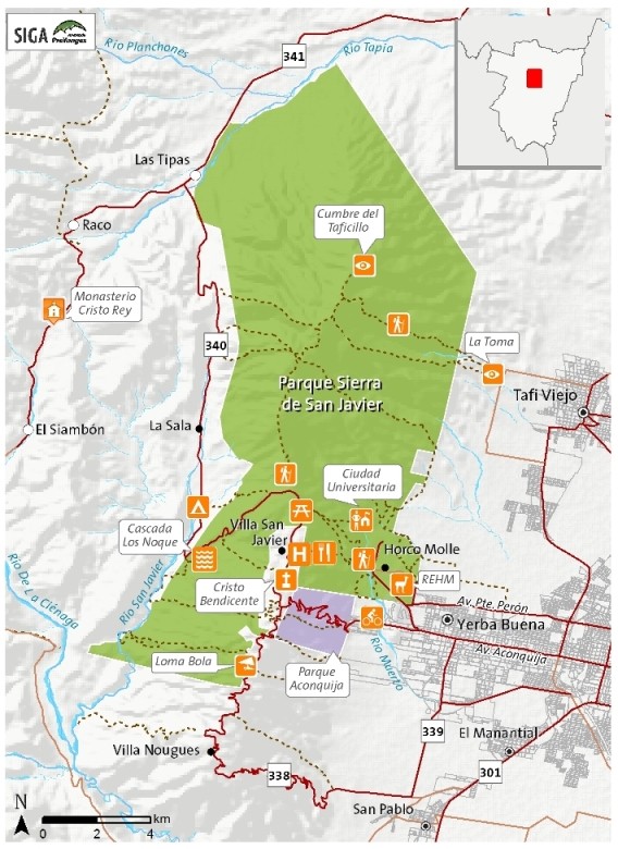
Sierra de San Javier Park is located at 11 km to the West of San Miguel de Tucumán by Provincial Route Nº 340. With around 14,000 hectares, it covers 74% of San Javier Mountains range and it is a real delight to those who visit it. Together with Aconquija Provincial Park in the south and Horco Molle Experimental wildlife Park in the east, they preserve environments, natural resources and watersheds and provide facilities for recreation and educational purposes in order to transfer values of the area to inhabitants and society. Most of its vegetation belongs to Yungas eco-areas. It was created in 1973. The National University of Tucumán is in charge of it.
The whole range mountain is a protected area. Even though balance between forests, pastures and inhabitants, in a legal frame, is a constant challenge.
Along the visits in the park, tourist will find several signs with the appropriate information about different walks, available services and rules of behavior in order to preserve the environment. In case of doubts, park rangers will help you to understand the messages of nature and they will explain conservations guidelines.
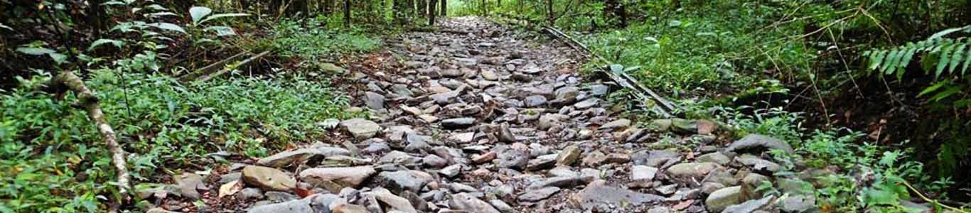
There are different paths in the park for those who love trekking and adventure:
Anta Yuca Path: it is possible to observe the nature changes from a crop environment to secondary forests. Difficulty is low. It takes an hour and a half and it is at 2,500 above the sea level.
Las Yungas Path: it takes 15 minutes. It goes around Horco Molle University Residency through the basal forest until Las Cañas stream.
La Cascada Path: this path goes up Noque River to an attractive waterfall, a place to picnic or camp. On summer you can enjoy the crystal clear waters of the river.
Puerta del Cielo Path: It goes through the whole of the Yungas mountain forest, where there are two floors: the basal forest between 600 and 800 meters high and the forest of mirtáceas between 800 and 1,200 meters high. Along the way, unique panoramic views of San Miguel de Tucumán will be seen. At the end of the path, summer village San Javier will be found. Difficulty is mild and it takes around two hours and a half as a whole. It is 1,800 m long.
The Funicular Path: There are only three bridges nowadays. Along the way, visitors can see some old remains and go through the Yunga basal forest. Difficulty is low. It takes an hour as a whole and 1,600 m travelled distance.
Velardez or Nina’s Path: Visitors have to climb through the jungle to the summit by pastures. The path takes between 8 and 10 hours on foot as a whole. It starts in Uttinger Street until the summit of Taficillo.
There are some camping, picnic and barbecue areas on the park.
Location:
The whole range mountain is a protected area. Even though balance between forests, pastures and inhabitants, in a legal frame, is a constant challenge.
Along the visits in the park, tourist will find several signs with the appropriate information about different walks, available services and rules of behavior in order to preserve the environment. In case of doubts, park rangers will help you to understand the messages of nature and they will explain conservations guidelines.
There are different paths in the park for those who love trekking and adventure:
Anta Yuca Path: it is possible to observe the nature changes from a crop environment to secondary forests. Difficulty is low. It takes an hour and a half and it is at 2,500 above the sea level.
Las Yungas Path: it takes 15 minutes. It goes around Horco Molle University Residency through the basal forest until Las Cañas stream.
La Cascada Path: this path goes up Noque River to an attractive waterfall, a place to picnic or camp. On summer you can enjoy the crystal clear waters of the river.
Puerta del Cielo Path: It goes through the whole of the Yungas mountain forest, where there are two floors: the basal forest between 600 and 800 meters high and the forest of mirtáceas between 800 and 1,200 meters high. Along the way, unique panoramic views of San Miguel de Tucumán will be seen. At the end of the path, summer village San Javier will be found. Difficulty is mild and it takes around two hours and a half as a whole. It is 1,800 m long.
The Funicular Path: There are only three bridges nowadays. Along the way, visitors can see some old remains and go through the Yunga basal forest. Difficulty is low. It takes an hour as a whole and 1,600 m travelled distance.
Velardez or Nina’s Path: Visitors have to climb through the jungle to the summit by pastures. The path takes between 8 and 10 hours on foot as a whole. It starts in Uttinger Street until the summit of Taficillo.
There are some camping, picnic and barbecue areas on the park.
Location: