
Tucumán is well-known as the Garden of the Republic of Argentina. Its landmarks and history go beyond borders. Besides, diversity has a leading role and green is the predominant colour. There is a secret in Tucumán. This secret cannot be seen even in the most stunning photos. That is why; this section invites you to discover the secret spots of Tucumán.
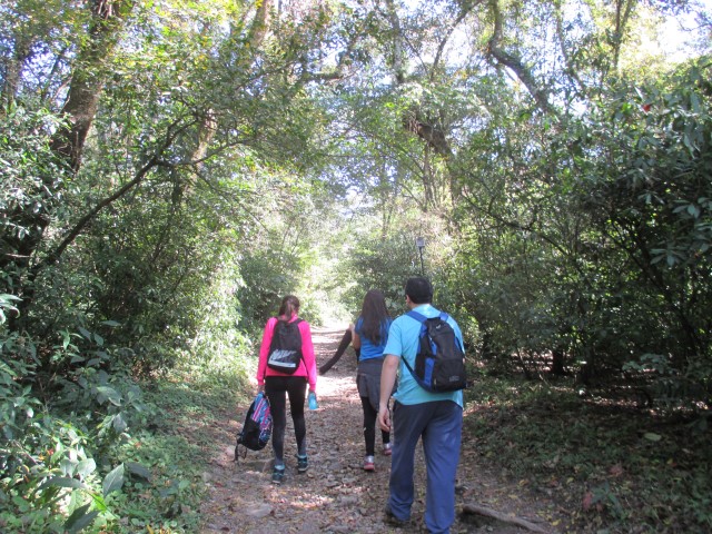
Hiking is an activity which allows us to be in contact with nature. Walking through the paths is a personal challenge and a unique experience of human and cultural exchanges. Our Eco-Paths are interconnected. There is a wide range of landscapes from yungas vegetation up to summit high pastures. Besides, there are protected archaeological sites together with a latent ancient culture.
Here is all the useful information about the Eco-Paths of the province.
- EL FUNICULAR PATH
Location: Horco Molle – Yerba Buena
Starting Point: Primary Health Care Centre in Horco Molle (the same starting point of “Heaven Doors” Path)
Ending Point: Funicular 4th bridge
Duration: 45 minutes
Difficulty: Low
Closed season: It does not have
Recommended season: The whole year
- HEAVEN DOORS (PUERTAS DEL CIELO) PATH
Location: Horco Molle – Yerba Buena
Starting Point: Primary Health Care Centre in Horco Molle (the same starting point of “Funicular” Path)
Ending Point: 12 Street, San Javier Village
Duration: 1 hour and a half
Difficulty: Low
Closed season: It does not have
Recommended season: The whole year
- 33 HOUSES PATH
Location: San Javier
Starting Point: 33 Houses of National University of Tucumán
Ending Point: Gate on Provincial Route Nº 340
Duration: 1 hour and a half
Difficulty: Intermediate
Closed season: It does not have
Recommended season: The Whole Year
- LA SALA VALEY PATH - POTRERO DE LAS TABLAS
Location: La Sala Valley- San Javier
Starting Point: no name
Ending Point: Don Cristóbal Maturano Spot
Duration: Between 5 and 7 hours a session
Difficulty: Intermediate - Demanding
Closed season: It does not have
Recommended season: From March to October
- EL NOGALITO PATH – MALA MALA
Location: El Nogalito Town
Starting Point: El Nogalito
Ending Point: Pie de la Cuesta Spot
Duration: 4 days (5 up to 6 hours walking)
Difficulty: Demanding/very demanding
Closed season: It does not have
Recommended season: March up to November
- NOQUE RIVER CASCADE PATH
Location: San Javier
Starting Point: Provincial Road Nº 340 - KM 10
Ending Point: Noque River Cascade
Duration: 30 minutes going
Difficulty: Low
Closed season: It does not have
Recommended season: The whole year
- EL TAFICILLO (NINA VELÁRDEZ) PATH
Location: Tafí Viejo
Starting Point: Tafí Viejo Municipal ex-Inn
Ending Point: El Taficillo Summit
Duration: 4 up to 6 hours going – 6 up to 8 hours coming
Difficulty: Intermediate - Demanding
Closed season: From December to March
Recommended Season: From April to December
-EL PELAO HILL PATH
Location: El Mollar
Starting Point: La Banda Bridge
Ending Point: La Banda Bridge
Duration: 2 hours
Difficulty: Low
Closed season: It does not have
Recommended season: The whole year
- CAÑADA DEL MUÑOZ PATH
Location: El Mollar
Starting Point: Toma de agua Spot
Ending Point: Provincial Road Management Spot on Provincial Route Nº 325
Duration: 8 hours
Difficulty: Low - Intermediate
Closed season: It does not have
Recommended season: From April up to November
- QUEBRADA DEL PORTUGUÉS PATH
Location: El Mollar
Starting Point: El Rincón Town
Ending Point: Powerhouse
Duration:4 hours
Difficulty: Intermediate - Demanding
Closed season: From January up to February
Closed season: From March up to December
- MUÑOZ HILL PATH
Location: El Mollar
Starting Point: Provincial Route Management Spot on Provincial Route Nº 325
Ending Point: Muñoz Hill Summit
Duration: 5 Days
Difficulty: Very demanding
Closed season: It does not have
Recommended season: From May up to October
- ÑUÑORCO GRANDE HILL PATH
Location: El Mollar
Starting Point: El Mollar main square
Ending Point: Ñuñorco Grande Hill Summit
Duration: From 5 to 7 hours to go up – from 2 to 3 to go down
Difficulty: Intermediate/very demanding
Closed season: It does not have
Recommended season: From April to October
- LOS ALISOS NATIONAL PARK PATH
Location: Alpachiri - Concepción
Starting Point: Santa Rosa Campsite
Ending Point: The Cascade (La Cascada)
Duration: 4 to 5 days according to the schedules
Difficulty: Very demanding
Closed season: It does not have
Recommended season: From March to October
- THE STREAM (EL CHORRO) PATH
Location: Escaba
Starting Point: Down Escaba
Ending Point: The stream (El Chorro)
Duration: 6 hours going – 9 hours going and coming
Difficulty: Intermediate - Demanding
Closed season: It does not have
Recommended season: From March to October
- THE TREASURE LAKE PATH
Location: Cochuna Town- Concepción
Starting Point: Cochuna Shelter
Ending Point: Treasure Lake
Duration: From 5 to 6 hours going – 9 hours going and coming
Difficulty: Intermediate/Demanding
Closed season: It does not have
Recommended season: From April to October
-HUALINCHAY - CHUCHAYO PATH
Location: San Pedro de Colalao
Starting Point: Coronel Zelaya School Nº 358
Ending Point: Mirador Los Alisos (Los Alisos Viewpoint)
Duration: 6 hours going – 9 hours going and coming
Difficulty: Intermediate - Demanding
Closed season: It does not have
Recommended season: April to October